Map Location
How to reach us
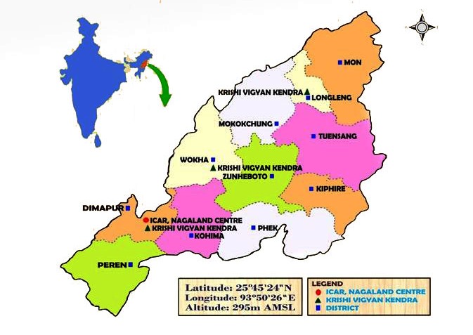
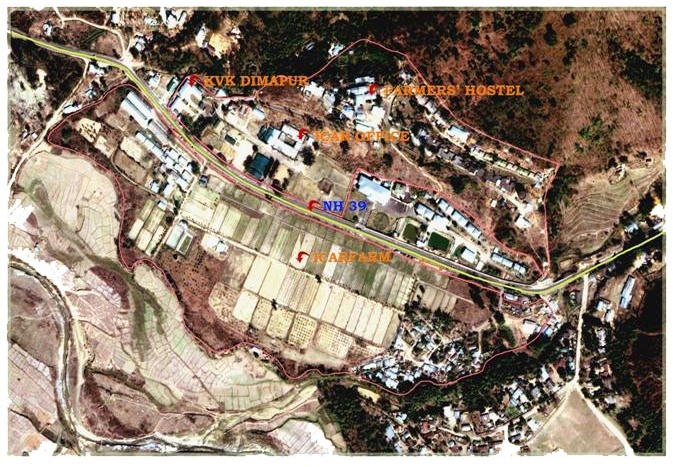
ICAR Research Complex for NEH Region, Nagaland Centre is situated adjacent to NH-39 along the Dimapur - Kohima route, which is about 25km far from Dimapur having a latitude of 25o45'24"N, longtitude of 93o50'26"E, and altitude of 295m AMSL. The State falls under monsoon zone. The annual rainfall varies from 2000 to 2500 mm. However, the state receives considerable amount of rainfall during pre-monsoon (March-May) and post monsoon (October-November) periods, with an annual humidity of 70 to 80% and average temperature range of 10oC to 25oC. The average bright sunshine hours received in the state is 2-5 hours during monsoon and 7-8 hours during winter. The topography is mostly hilly and has three distinct agro-climate zones. The agro-climatic conditions of the State are excellent for growing all types of fruits, vegetables, flowers, spices and condiments, aromatic and medicinal plants, plantation crops, etc., ranging from temperate to tropical crops under rain fed conditions.
ICAR Research Complex for NEH Region, Nagaland Centre is situated adjacent to NH-39 along the Dimapur - Kohima route, which is about 25km far from Dimapur having a latitude of 25o45'24"N, longtitude of 93o50'26"E, and altitude of 295m AMSL. The State falls under monsoon zone. The annual rainfall varies from 2000 to 2500 mm. However, the state receives considerable amount of rainfall during pre-monsoon (March-May) and post monsoon (October-November) periods, with an annual humidity of 70 to 80% and average temperature range of 10oC to 25oC. The average bright sunshine hours received in the state is 2-5 hours during monsoon and 7-8 hours during winter. The topography is mostly hilly and has three distinct agro-climate zones. The agro-climatic conditions of the State are excellent for growing all types of fruits, vegetables, flowers, spices and condiments, aromatic and medicinal plants, plantation crops, etc., ranging from temperate to tropical crops under rain fed conditions.
Map Location